
Geography
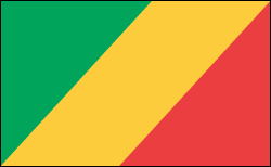
The Congo is situated in west-central Africa astride the equator. It borders Gabon, Cameroon, the Central African Republic, the Democratic Republic of the Congo, and the Angola exclave of Cabinda, with a short stretch of coast on the South Atlantic. Its area is nearly three times that of Pennsylvania. Most of the inland is tropical rain forest, drained by tributaries of the Congo River.
Government
Dictatorship.
Fast Facts about Congo
Time
GMT/UTC + 1
Population
3.7 million
Borders
Angola, Cameroon (closed), Central African Republic (closed), Democratic Republic of Congo and Gabon
Seasons
Wet (October to May), dry (June to September)
Telephone
Country code 242; international access code 00
ATMs
None
Budget
US$30 to US$60 a day
Capital
Brazzaville
Visa
US$70 for a 15-day, multiple-entry visa, which can be bought at border; US$120 for a one-month visa if bought at embassy
Languages
French, Lingala, Munukutuba, Lari
Area
342, 000 sq km
Money
Central African CFA; US$1 = CFA498
Borders
Angola, Cameroon (closed), Central African Republic (closed), Democratic Republic of Congo and Gabon
Visa
US$70 for a 15-day, multiple-entry visa, which can be bought at border; US$120 for a one-month visa if bought at embassy
Seasons
Wet (October to May), dry (June to September)
Area
342,000 sq km
Population
3.7 million
ATMs
None
Capital
Brazzaville
Budget
US$30 to US$60 a day
Languages
French, Lingala, Munukutuba, Lari


No comments:
Post a Comment