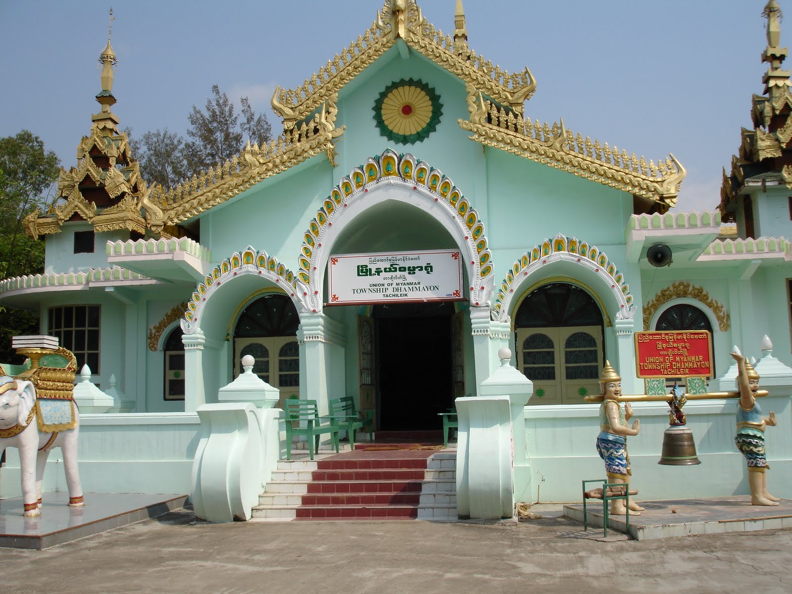
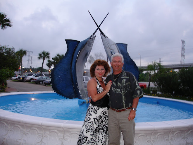
 Kathy and Greg in front of
 the Temple in Myanmar
 Kathy & Greg in a Rickshaw in Myanmar

 Once across the border we rented Rickshaws which took us to visit this small Temple. Inside they sold a heavenly scented gardenia soap and face poultices made from tree bark. I bought several bars of the soap.
 We were not allowed to take any photos at the border. We were told not to take any photos of anyone in uniform or any official building , we were also told not to speak of the government or its leaders at all or we could be arrested.
 This was a much larger temple we were taken to. We were met at the gates by local guides who spoke the best English we had heard all trip. The lady and her small son who took me around was very informative. The majority of what I learned about Temple ritual I learned from her. I learned that the reclining Buddha was my patron Buddha.that flowers are given to the Buddha as an offering, that you wash the buddha 3 times and that you ring the gong 9 times

 In this area we were met by local women selling their wares. I bought a set of handpainted pictures painted by the monks and a few other items stamps, money etc.
 I am told that there is a huge casino in Myanmar and that Thai people routinely cross the border to gamble here, since gambling is illegal in Thailand.
 Kathy & Greg in a Rickshaw in Myanmar
 Once across the border we rented Rickshaws which took us to visit this small Temple. Inside they sold a heavenly scented gardenia soap and face poultices made from tree bark. I bought several bars of the soap.
 We were not allowed to take any photos at the border. We were told not to take any photos of anyone in uniform or any official building , we were also told not to speak of the government or its leaders at all or we could be arrested.
While walking briskly thru the market on our way back to the border, I saw some beautiful costume jade jewelry. The vendor asked a ridiculous price so I declined and walked away
The next thing I knew this woman dressed in Indonesian garb was next to me telling me she had the same jewelry and would make me a better deal.. I said I had to go . She tracked me to the border crossing and I ended up buying her jewelry for about $65.00 US. This woman looked like the devil. Her face was as black and evil looking as could be and she had a diamond chip in her nose
The jewelry was very pretty but it ended up getting stolen from my luggage on the bus from Phuket airport to the hotel. They took the prettiest pieces with the rhinestones. I guess they thought they were diamonds. Anyway I kind of felt like this jewelry was cursed, so I hope the thief gets whats coming to him. I call it the devils jade.
Something unusual was cigarette vendors. They carried cardboard cases around their necks and sold a variety of cigarettes. If you even glanced like you could be interested they would also offer up Viagra and Cialis. The guy kept chasing my husband trying to sell him Viagra , I kept saying My husband doesn't need it, He is strong like Bull....
 This was a much larger temple we were taken to. We were met at the gates by local guides who spoke the best English we had heard all trip. The lady and her small son who took me around was very informative. The majority of what I learned about Temple ritual I learned from her. I learned that the reclining Buddha was my patron Buddha.that flowers are given to the Buddha as an offering, that you wash the buddha 3 times and that you ring the gong 9 times
 In this area we were met by local women selling their wares. I bought a set of handpainted pictures painted by the monks and a few other items stamps, money etc.
  I am told that there is a huge casino in Myanmar and that Thai people routinely cross the border to gamble here, since gambling is illegal in Thailand.
 Burma
From Wikipedia, the free encyclopedia
From Wikipedia, the free encyclopedia
Naypyidaw19°45′N 96°6′E / 19.75°N 96.1°E / 19.75; 96.1
Largest city
Yangon (Rangoon)
Official language(s)
Burmese
Recognised regional languages
Jingpho, Kayah, Karen, Chin, Mon, Rakhine, Shan
Official scripts
Burmese script
Demonym
Burmese/Myanma
Government
Presidential republic
-
President
Thein Sein
-
Population
2009 estimate
55,400,000[ -
1983 census
33,234,000 (3)
Density
73.9/km2 (119th)191.5/sq mi
GDP (PPP)
2010 estimate
Total
$76.473 billion[2]
Per capita
$1,250[2]
Per capita
$702[2]
HDI (2010)
0.451[3] (low) (132nd)
Currency
kyat (K) (MMK)
Time zone
MST (UTC+6:30)
Drives on the
right[4]
Internet TLD
.mm
Calling code
95
Some governments recognise Rangoon as the national capital.[5]
Burma (i /ˈbɜrmə/), officially the Republic of the Union of Myanmar (i /ˌmjɑːnˈmɑr/; Burmese: , Pyidaunzu Thanmăda Myăma Nainngandaw, pronounced [pjìdà̀uɴzṵ θà̀ɴməda̯ mjəmà nàiɴŋàɴdɔ̀]) is a country in Southeast Asia. The country is bordered by the People's Republic of China on the northeast, Laos on the east, Thailand on the southeast, Bangladesh on the west, India on the northwest, and the Bay of Bengal to the southwest, with the Andaman Sea defining its southern periphery. One-third of Burma's total perimeter of 1,930 kilometres (1,200 mi) forms an uninterrupted coastline. Burma is the second largest country by geographical area in Southeast Asia.[6]
The country's culture, heavily influenced by those of its neighbours, is based on Theravada Buddhism intertwined with local elements. Burma's diverse population has played a major role in defining its politics, history, and demographics in modern times, and the country continues to struggle to overcome its ethnic tensions. The military has dominated government since General Ne Win led a coup in 1962 that toppled the civilian government of U Nu. From that point, Burma's leadership went under the control of the military-led State Peace and Development Council. It remained so until 2011, when the council was dissolved following the 2010 election and subsequent inauguration of Burma's civilian government.
The United Nations and several other organizations have reported consistent and systematic human rights violations in the country, including child labour, human trafficking and a lack of freedom of speech. However, since the dispersion of the country's military regime, some groups within Burma have attempted to adopt a new constitution in hopes of creating a more modern, democratic nation.
Etymology
Main article: Names of Burma
"Burma" is derived from the Burmese word "Bamar" (), which in turn is the colloquial form of Myanmar () (or Mranma in old Burmese), both of which historically referred to the majority Burmans (or the Bamar). Depending on the register used the pronunciation would be "Bama" (pronounced [bəmà]), or "Myanmah" (pronounced [mjəmà]). The name "Burma" has been in use in English since the time of British colonial rule.
In 1989, the military government officially changed the English translations of many colonial-era names, including the name of the country to "Myanmar". This prompted one scholar to coin the term "Myanmarification" to refer to the top-down programme of political and cultural reform in the context of which the renaming was done. The renaming remains a contested issue.[7]
While most of the name changes are closer to their actual Burmese pronunciations, many opposition groups and countries continue to oppose their use in English because they recognise neither the legitimacy of the ruling military government nor its authority to rename the country or towns in English.[8] Various non-Burman ethnic groups choose not to recognise the name because the term Myanmar has historically been used as a label for the majority ethnic group, the Bamar, rather than for the country.[9][10][11]
Various world entities have chosen to accept or reject the name change. The United Nations, of which Burma (under the name Myanmar) is a member, endorsed the name change five days after its announcement by the junta.[12] However, governments of many countries including Australia, Canada, France,[13] the United Kingdom and the United States[14] still refer to the country as "Burma", with varying levels of recognition of the validity of the name change itself. Others, including the Association of Southeast Asian Nations and the governments of Germany, India, Japan,[15] Russia[16] and the People's Republic of China recognise "Myanmar" as the official name.
Media usage is also mixed. In spite of the usage by the United States government, some American news outlets including The New York Times, The Wall Street Journal, The International Herald Tribune and CNN, and international news agencies the Associated Press, Reuters and Agence France-Presse have adopted the name "Myanmar". The name "Burma" is still widely used by other news outlets, including Voice of America, The Washington Post, the BBC, ITN, most British newspapers, The Times of India and Time. Other sources often use combined terms such as "Burma, also known as Myanmar." Some media outlets that use "Myanmar" refer to "Burma" as the nation's "colonial name."[17][18][19]
Uncertainty among English speakers on how to pronounce "Myanmar" gives rise to pronunciations such as /ˈmjɑːn.mɑr/, /maɪ.ənˈmɑr/, /ˈmiː.ən.mɑr/ and /miːˈæn.mɑr/. The BBC recommends /mjænˈmɑr/.[20][21][22] The common pronunciation in Burmese is [mjəmà].
On 21 October 2010 some media reported that the government changed the official name to Republic of the Union of Myanmar, which was established as part of the 2008 Constitution.[23] But this information was not confirmed by any Burmese government sources nor any other credible sources till 30 March 2011 – the new name Republic of the Union of Myanmar is in effect as of inaugration of new government.[24] Prior to this, the country was known formally as the Union of Myanmar since 1989. This had itself replaced the previous designation of the Socialist Republic of the Union of Burma used in the 1974 Constitution, which in turn had replaced the 1947 Constitution adopted following independence, which had referred simply to the Union of Geography of Burma
The Irrawaddy Delta, which is approximately 50,400 km2 (19,460 sq mi) in area, is largely used for rice cultivation.[25]
Buddhist monastery on Taung Kalat southwest of Mount Popa
Burma, which has a total area of 678,500 square kilometres (262,000 sq mi), is the largest country in mainland Southeast Asia, and the 40th-largest in the world. It lies between latitudes 9° and 29°N, and longitudes 92° and 102°E.
It is bordered to the northwest by Chittagong Division of Bangladesh and Mizoram, Manipur, Nagaland and Arunachal Pradesh of India to the northwest. Its north and northeast border straddles the Tibet and Yunnan regions of China for a Sino-Burman border total of 2,185 kilometres (1,358 mi). It is bounded by Laos and Thailand to the southeast. Burma has 1,930 kilometres (1,200 mi) of contiguous coastline along the Bay of Bengal and Andaman Sea to the southwest and the south, which forms one quarter of its total perimeter.[26]
In the north, the Hengduan Shan mountains form the border with China. Hkakabo Razi, located in Kachin State, at an elevation of 5,881 metres (19,295 ft), is the highest point in Burma.[27] Three mountain ranges, namely the Rakhine Yoma, the Bago Yoma, and the Shan Plateau exist within Burma, all of which run north-to-south from the Himalayas.[28] The mountain chains divide Burma's three river systems, which are the Ayeyarwady, Salween (Thanlwin), and the Sittaung rivers.[25] The Ayeyarwady River, Burma's longest river, nearly 2,170 kilometres (1,348 mi) long, flows into the Gulf of Martaban. Fertile plains exist in the valleys between the mountain chains.[28] The majority of Burma's population lives in the Ayeyarwady valley, which is situated between the Rakhine Yoma and the Shan Plateau.
Climate
Main article: Climate of Burma
Limestone landscape of Mon State
Much of the country lies between the Tropic of Cancer and the Equator. It lies in the monsoon region of Asia, with its coastal regions receiving over 5,000 mm (196.9 in) of rain annually. Annual rainfall in the delta region is approximately 2,500 mm (98.4 in), while average annual rainfall in the Dry Zone, which is located in central Burma, is less than 1,000 mm (39.4 in). Northern regions of the country are the coolest, with average temperatures of 21 °C (70 °F). Coastal and delta regions have an average maximum temperature of 32 °C (89.6 °F).[25]
[edit] Wildlife
The country's slow economic growth has contributed to the preservation of much of its environment and ecosystems. Forests, including dense tropical growth and valuable teak in lower Burma, cover over 49% of the country, including areas of acacia, bamboo, ironwood and michelia champaca. Coconut and betel palm and rubber have been introduced. In the highlands of the north, oak, pine and various rhododendrons cover much of the land.[29] Heavy logging since the new 1995 forestry law went into effect has seriously reduced forest acreage and wildlife habitat.[30] The lands along the coast support all varieties of tropical fruits and once had large areas of mangroves although much of the protective mangroves have disappeared. In much of central Burma (the Dry Zone), vegetation is sparse and stunted.
Typical jungle animals, particularly tigers and leopards, occur sparsely in Burma. In upper Burma, there are rhinoceros, wild buffalo, wild boars, deer, antelope, and elephants, which are also tamed or bred in captivity for use as work animals, particularly in the lumber industry. Smaller mammals are also numerous, ranging from gibbons and monkeys to flying foxes and tapirs. The abundance of birds is notable with over 800 species, including parrots, peafowl, pheasants, crows, herons, and paddybirds. Among reptile species there are crocodiles, geckos, cobras, Burmese pythons, and turtles. Hundreds of species of freshwater fish are wide-ranging, plentiful and are very important food sources
History of Burma
After the First Burmese War, the Ava kingdom ceded the provinces of Manipur, Tenassarim, and Arakan to the British.[32] Rangoon and southern Burma were incorporated into British India in 1853. All of Burma came directly or indirectly under British India in 1886 after the Third Burmese War and the fall of Mandalay.[32] Burma was administered as a province of British India until 1937 when it became a separate, self-governing colony. The country became independent from the United Kingdom on 4 January 1948, as the "Union of Burma".
It became the "Socialist Republic of the Union of Burma" on 4 January 1974, before reverting to the "Union of Burma" on 23 September 1988. On 18 June 1989, the State Law and Order Restoration Council (SLORC) adopted the name "Union of Myanmar" for English transliteration. This controversial name change in English, while accepted in the UN and in many countries, is not recognised by the Burmese democracy movement and by nations such as Canada, the United Kingdom and the United States


No comments:
Post a Comment